TRAINING
Size an FTTH Network
Educational objectives :
- Master the Engineering Rules in ZMD, ZTD-BD & RIP from PA to PB (PRE)
- Being able to design a fiber optic network (explore possibilities of optical cable routing and equipment / infrastructure set up) on a GIS.
- Read and interpret any kind of plan.
- Perform or update the synoptic.
- Modify the technical plans based on information provided by the field and finalize the study.

Training
70 hours spread over 10 days
- Hours: 8:30 a.m. to 12 p.m. - 1:30 p.m. to 5 p.m.
- Location: your local / virtual classroom
Not eligible for CPF

Training content
- Reminder of the PMZ downstream architecture
- Rules for connecting buildings and pavilions
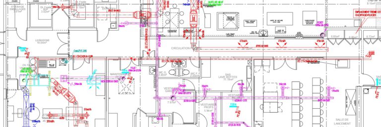
- Technical aspects: - Single fiber engineering without coupler - PMZ distribution capacity - Metering of collective residences and professional premises - Creeping column and terminal distribution cables
- The different types of PB, their positioning and their area of influence
- General rule for the implementation of PRE
- Study of the back area of the PA
- Exercises
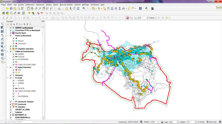
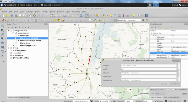
- Knowledge review of the QGIS Initiation cycle
- Selection of several plugins (extensions) that can be used in QGIS to add specific functionalities to the software in order to better size a fiber optic network.
- Use the mapping tools linked to QGIS (Google Maps, Street View, GéoPortail, ...
- Read and interpret any kind of plan.
- Update plans
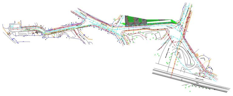
- Creating plans from picketing
- Check the consistency between plans and terrain
- Casing and sizing (Distribution 2 & 3, ZAPA)
- Choice of material for sizing (cables, boxes, etc.)
- Automation of dimensioning thanks to plugins (extensions)
- Carry out the data transfer
- Production of ZAPA synoptics
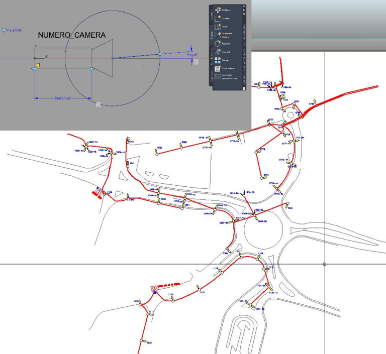
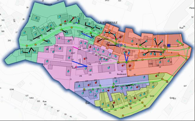
Sizing of a ZPA with QGIS (D2 & D3)
Planning
Day 1 to 3
FTTH Engineering Rule and Rules of Application - 2.5 days:
Technical and practical development of regulatory and business aspects with practical exercises.
18 h
Day 3 to 6
Sizing of an FTTH network on the QGIS GIS:
Complete approach to the QGIS cycle: discovery and deepening, use of mapping tools. Reading, interpreting and updating plans.
24 h
Day 7 to 10
Practical exercises :
Practice of subjects studied with QGIS (D2 & D3) & sizing of a ZPA.
28 h
Each module will be followed by practical workshops on the supports provided in order to apply the subject addressed according to the trainee's situation
Profiles trainees
- All public
Materials Required
- A computer
- A remote connection
Prerequisites
-
- Have followed the QGIS initiation or QGIS mastery or Common use of technical infographic tools in a Windows environment.
- Knowledge of the topology of the fiber optic network.
Want to join?
Select the formula that suits you
Customized training?
You have a specific need in this area?
Let's talk about it, we have solutions.
Let's talk about it, we have solutions.
Accessibility
Rate
Access delay
Accessibility
Accessibility for people with disabilities: For anyone with a disability, please tell us the type of disability at this address contact@scal.biz. We will adapt or can direct you to a partner who supports this kind of disability.
Rate
To know our prices, contact us.
Access delay
Following your registration and validation of the prerequisites, we establish with you the schedule for setting up your training.
Overall satisfaction
0 /10
attendance rate
0 %